
Maps creation is now integrated into computing systems and smart devices as tools that allow people navigate through geographic locations, identification of geographic locations, analyze different land formations, waterways and more.
What does Geographic Information Systems mean?
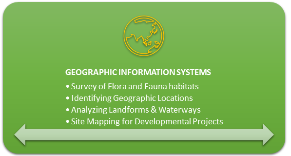
Geographic Information Systems (GIS) is basically a system that captures, stores, analyzes and displays various data that are on the surface of Earth. The data can be used for a variety of purposes that include detecting and analyzing change in landforms, vegetation, waterways and even the change in urban areas over a span of time.
GIS is also used for purposes such as projects for development, surveying flora and fauna habitats, and site selection for erecting buildings in ideal locations to name a few.
Entry Requirements into Geographic Information Systems Degree
| Degree | Credits (May Vary) | Program Duration | General Admission Requirements (May Vary by College) |
| Bachelor’s Degree | 120 Credits | 4 Years | Official High School Transcripts/Minimum Required GPA |
| Master’s Degree | 30 Credits | 2 Years | A Bachelor’s Degree with a minimum GPA of 2.5 |
Online Bachelor’s Degree in Geographic Information Systems
1. Delta State University
Program: Bachelor of Applied Science – Geospatial Analysis and Intelligence
Tuition: $351/credit hour (resident); $500/credit hour (International Student)
Credits: 120 Credits.
Accreditation: The program is accredited by the United States Geospatial Intelligence Foundation (USGIF). The university is accredited by the SACSCOC.
Ranking: The university ranks #349 in Colleges with the Best Professors in America.
Financial aid: Available, with 98% of students receiving financial aid.
The bachelor’s degree program in Geospatial Analysis and Intelligence offers coursework to students on a broad topic coverage of geographic information systems and its application. This accredited program will help prepare students for both a career in GIS or to pursue their graduate degrees.
4 Online Master’s Degree in Geographic Information Systems
1. Northwest Missouri State University
Program: MBA – Geographic Information Systems
Tuition: $400/credit hour
Credits: 30 credits.
Accreditation: The program is accredited by the ACBSP. The university is accredited by the HLC.
Ranking: The university is ranked #18 in Colleges with the Best Professors in Missouri.
Financial aid: Available, with 98% of students receiving financial aid.
This Geographic Information Systems program will help students to learn about the fundamentals of spatial analytics, cartography, and geostatistics that will further help them develop the skills and knowledge required to implement GIS solutions.
2. George Mason University
Program: MS – Geoinformatics & Geospatial Intelligence
Tuition: $759.45/credit hour (in-state); $1674/credit hour (out-of-state)
Credits: 33 credits.
Accreditation: The program is accredited by the USGIF. The university is accredited by the SACSCOC.
Ranking: The university is ranked #120 in Top Public Universities in America.
Financial aid: Available, with 79% of students receiving financial aid.
This graduate program is designed to provide individuals with an up-to-date curriculum that addresses information leading to geographical locations, landforms monitoring complex phenomena and intelligent navigation during times of disasters in urban areas.
3. Michigan Technological University
Program: MS – Integrated Geospatial Technology
Tuition: $1,228/credit hour
Credits: 30 credits
Accreditation: The program is accredited by the Accreditation Board for Engineering and Technology (ABET). The university is accredited by the HLC.
Ranking: The university is ranked #36 in Top Public Universities in America.
Financial aid: Available, with 99% of students receiving financial aid.
An online master’s degree in Integrated Geospatial Technology includes coursework on remote-sensing technologies, use of complex tools and software for geographic mapping and analyzing the landforms on Earth to name a few.
4. University of Southern California
Program: MS – Human Security and Geospatial Intelligence
Tuition: $2,137/credit hour
Credits: 34 credits.
Accreditation: The program is accredited by the USGIF. The university is accredited by the WSCUC.
Ranking: The university ranks #25 in Colleges with the Best Professors in America.
Financial aid: Available, with 76% of students receiving financial aid.
The program is designed to provide in-depth knowledge on topics of geospatial data, analyzing geographic patterns, use of remote-sensing tools and software while also building management and leadership skills.
Is Geographic Information Systems a good major?
Considering the importance that geography has had over centuries up until now, acquiring a degree in Geographic Information Systems may very well be worth it for the following reasons:
- The Geographic Information Systems is a growing market where professionals make use of tools that determine and analyze locations that a good number of industries require for establishing their bases for operations and projects.
- GIS helps to identify natural disasters such as earthquakes, epidemics, wildfires, etc. and may help mitigate the loss from these events prior to the incident.
- The salaries of GIS professionals are competitive compared to other professions across several industries. The median salary for a Geospatial Analyst is recorded at $62,441 according to payscale.com
Also have a look at the top paying professions in Geographic Information Systems:
| Occupation | Median Annual Salary |
| Geographic Information Systems Manager | $76,960 |
| Water Resources Engineer | $71,630 |
| Transportation Planner | $63,333 |
| Geospatial Analyst | $62,441 |
| Geologist | $57,598 |
Source: Pay Scale
Are GIS degrees worth it?
A degree in Geographic Information Systems is worth it as the market for this particular field is still growing. The human population is increases by the year and this calls for better urban planning. Policy makers are adopting data-oriented decision making. As such, GIS professionals can play a major role in such areas of development.
Learning programming (Python, Java) and getting proficient in SQL will definitely fast-track your career.
The median salary for GIS professionals are also quite competitive and this bracket is quite likely to increase by 10% when individuals acquire a master’s degree in Geographic Information Systems.